The year 1889 was a landmark one for the Dominican Republic: our newly born nation had to ask itself how to present its face to the world, as the country was holding a 200-square-meter pavilion at the Exposition Universelle in Paris. Where were our icons? How about our national beauties, our collective strengths?

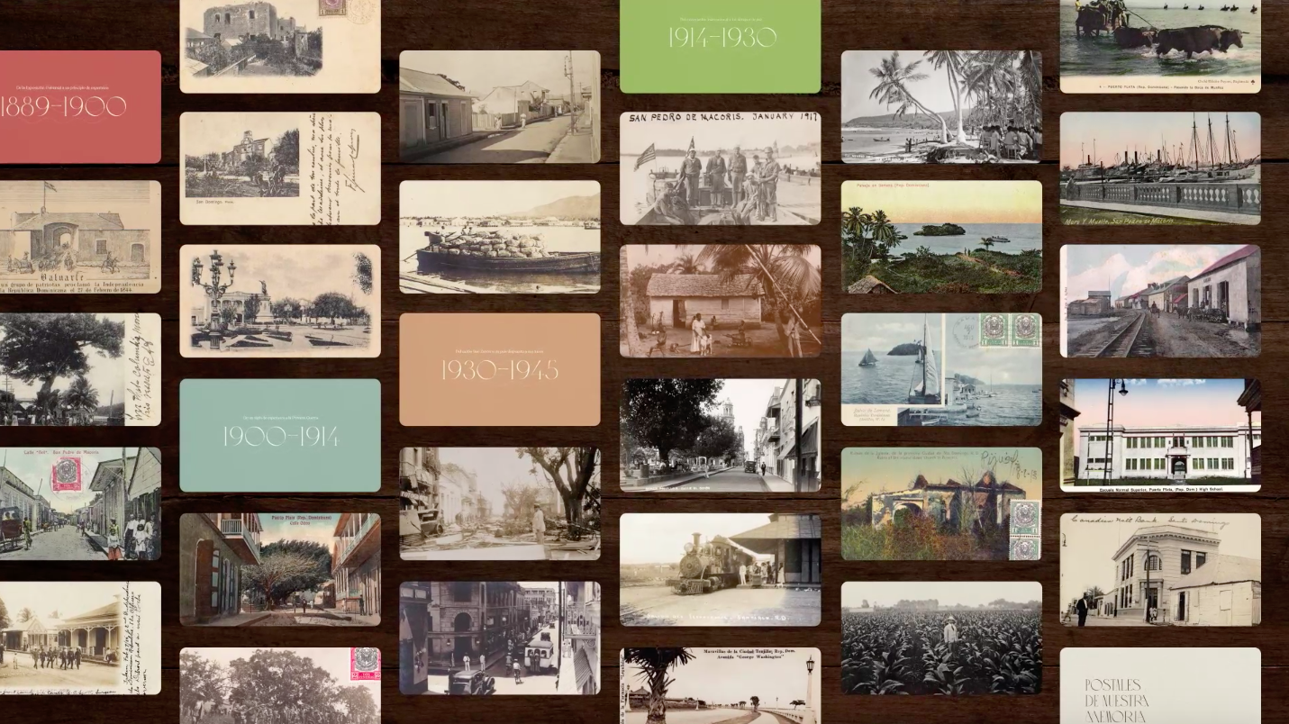
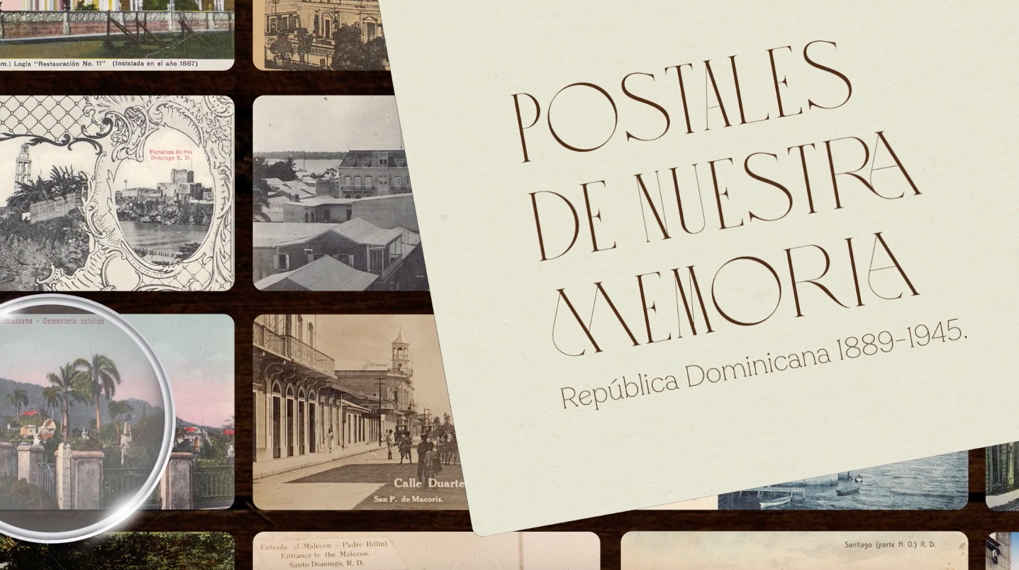
On top of that, another noteworthy event took place that same year: the Dominican Post Office produced and sent its peers around the globe a celebratory New Year’s card. Thus 1889 marked the gathering of a perfect storm, blending together a string of eye-catching situations: the desire to present the country internationally, the development of complex postal logistics and, beyond that, the awakening of our local printing industry. This explains why Miguel D. Mena used 1889 as the starting point of the story of an object that speaks of our national history in just two dimensions: the postcard.

In Postcard Memories, the Dominican writer and essayist explains the context behind a spectacular print archive. Therein contained are the many ways in which our towns became cities, our everyday customs became our national identity and our aspirations became our reality.

POSTCARD MEMORIES

From the Doctor’s Office to the… Tourist Office?

Prior to the birth of the postcard, many got to experience the wonders of the world via the stereoscopic image, an invention that created the illusion of three-dimensional depth by way of a set of binoculars. This technique was initially used in the field of medicine, as it made some features sharper to the human eye… and that was precisely what made it such a great fit for tourism purposes. The Dominican Republic was no exception: here’s a shot of the Fortaleza del Homenaje, as seen from the Ozama River. Its scarp-like character was practically gone circa 1938, when the city’s harbor came to life. Until then, this was the first thing visitors saw when they reached our capital.

The Dominican Republic Comes Out

The first prototype for a modern postcard produced in the country, with a set of measurements that would later become standard, came in 1889 thanks to our Post Office employees. It was an engraving of the Puerta del Conde, the spot where our nation had declared its independence —quite recently— in 1844. The main goal was to send the card overseas, so one can infer this is the way the country presented itself to the world: a set of solid government offices standing next to street vendors, farmers with their yokes and pedestrians aplenty. The nation wanted to showcase a peaceful, democratic and community-driven everyday life.

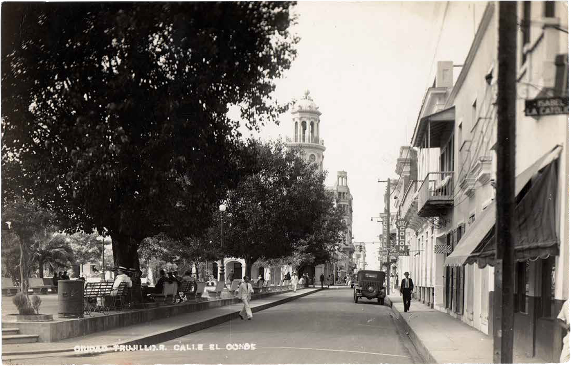
Imagining a Capital City

The early-20th-century version of Santo Domingo was a small city made mostly out of wood; coralline stone in certain buildings usually pointed to a colonial origin. Therefore, the postcards we produced spoke of the neural centers of our imaginary: the former Plaza de Armas that took the name of Parque Colón from 1892 onwards, the then-Palacio de Borgellá that become known as the Palacio de Gobierno (Government Palace) and the spot behind the ruins of Diego Colón’s Palace —what we now refer to as the Alcázar— bore the ceiba tree where his father allegedly tied up one of his caravel ships, as his crew entered the bank of the Ozama River during his first journey to the Americas.

You Can Count on Us Dominicans

The 1902 edition of the Encyclopaedia Britannica still registered our country under the misnomer of Santo Domingo, instead of labeling it “Dominican Republic.” This entry spoke of a capital city made up of 25 thousand inhabitants, while Puerto Plata had 15 thousand. And outside of these two main sites? Santiago de los Caballeros had a population of barely 12 thousand, while Montecristi had three thousand and Samaná just 1,300. In total, our nation’s estimated population was just a smidge north of half a million souls… which just comes to show that, back then, rural developments ruled this land.

Our New Icons

Montecristi grew increasingly richer thanks to maritime trade, and its public spaces reflected the ensuing boom: from the tramway tracks that ran across the beach to the public clock that made it to the city’s central park in March of 1895. The new icon was an initiative by Venezuelan businessman Benigno Daniel Conde Vásquez, who crowdfunded the acquisition of the 96-feet-tall structure created by French watchmaker Jean-Paul Garnier. The piece, which had been originally set in Saint-Germain-en-Laye, is still standing, and —thanks to a thorough restoration process— continuously spins its hands for a city that considers it its main landmark.

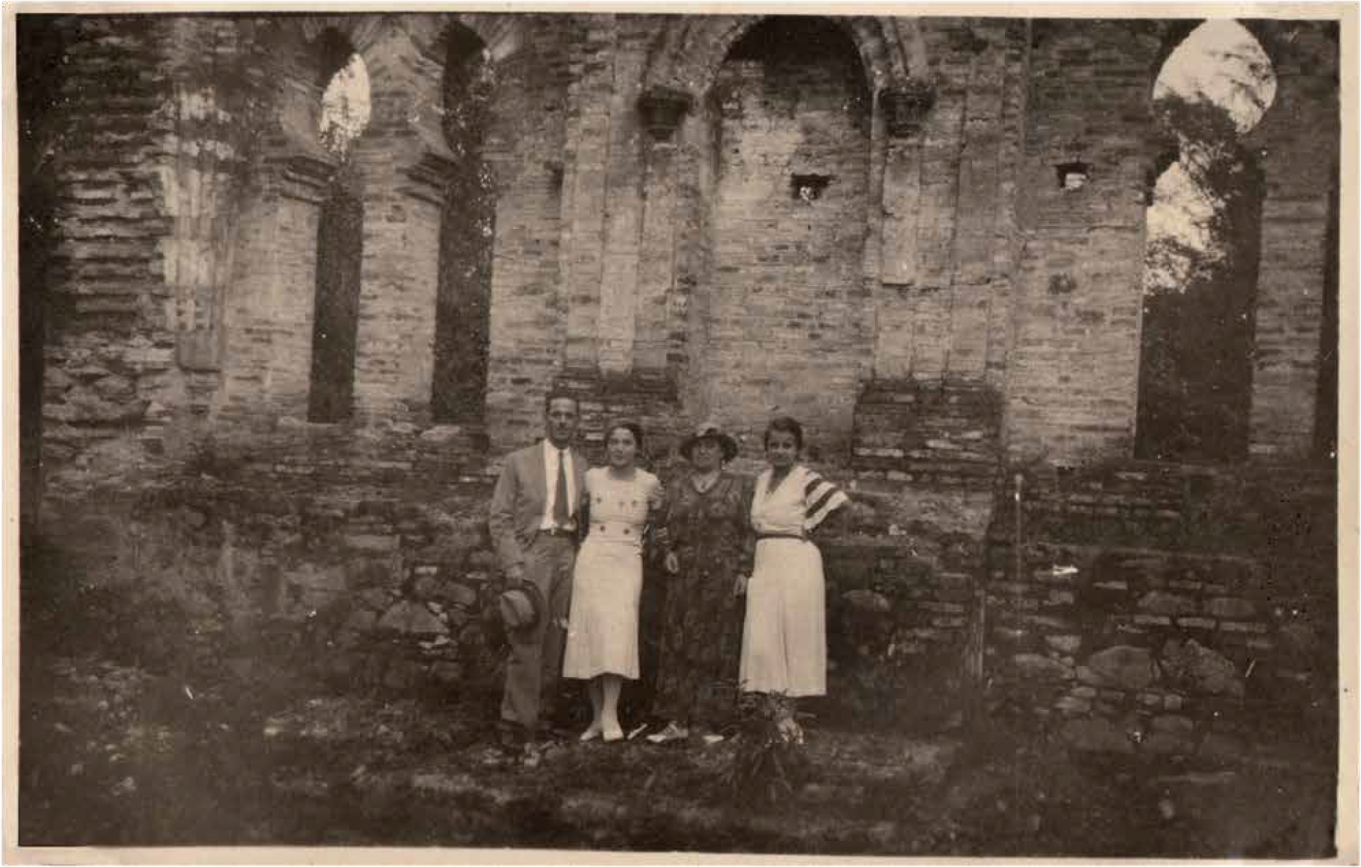
Some Everyday Charms

Puerto Plata’s modern era began in 1868, with the arrival of the Cuban emigrés who were escaping the neighboring island’s independence war. The coastal spot thus welcomed both businessmen and intellectuals, along with newcomers from faraway lands —such as the British— who left their mark in the city’s commercial development and the construction style of its new buildings. That explains why an early 20th-century postcard proudly displayed Puerto Plata’s everyday modernity: a school brimming with cutting-edge equipment during a visit from Emilio Prud’Homme, the writer and educator who famously authored the lyrics to our national anthem.

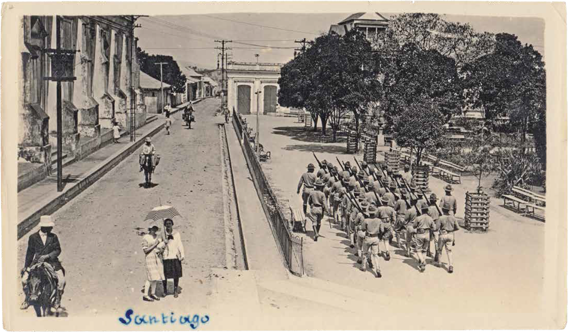
Keeping Ourselves Occupied during the Occupation

San Pedro de Macorís was another port city that experienced a swift boom. Just like Puerto Plata, this economic puissance manifested itself through its buildings —not just wooden ones, but the concrete creations that were quite the novelty in the entire country. But this postcard of the prolific city, published in 1920, also presents a nation in the middle of the American Occupation, which lasted from 1916 to 1924. The invading military forces did bring with them the makings of a modern country, thanks to strong investments on urban infrastructure and the nation’s network of roads.

Peace and Postcards

As a rebellious remnant of the autocratic leadership present since the country’s birth, the presidential position would exchange hands in a dizzyingly fast succession. But the American Occupation became a time of pacification, and thus, economic abundance. Some of the main witnesses of this era of social development were the country’s first postcard producers: the Viuda García Printers office in Santo Domingo suddenly got some company, thanks to the appearance of editing houses such as Perrota Dubús in Puerto Plata, Oliva in Montecristi and Los Muchachos in San Pedro de Macorís. These workshops left behind a large registry of the era’s images, including everyday rural and urban scenes throughout the country —such as this one from Parque Juan Pablo Duarte in Santiago de los Caballeros in 1920.

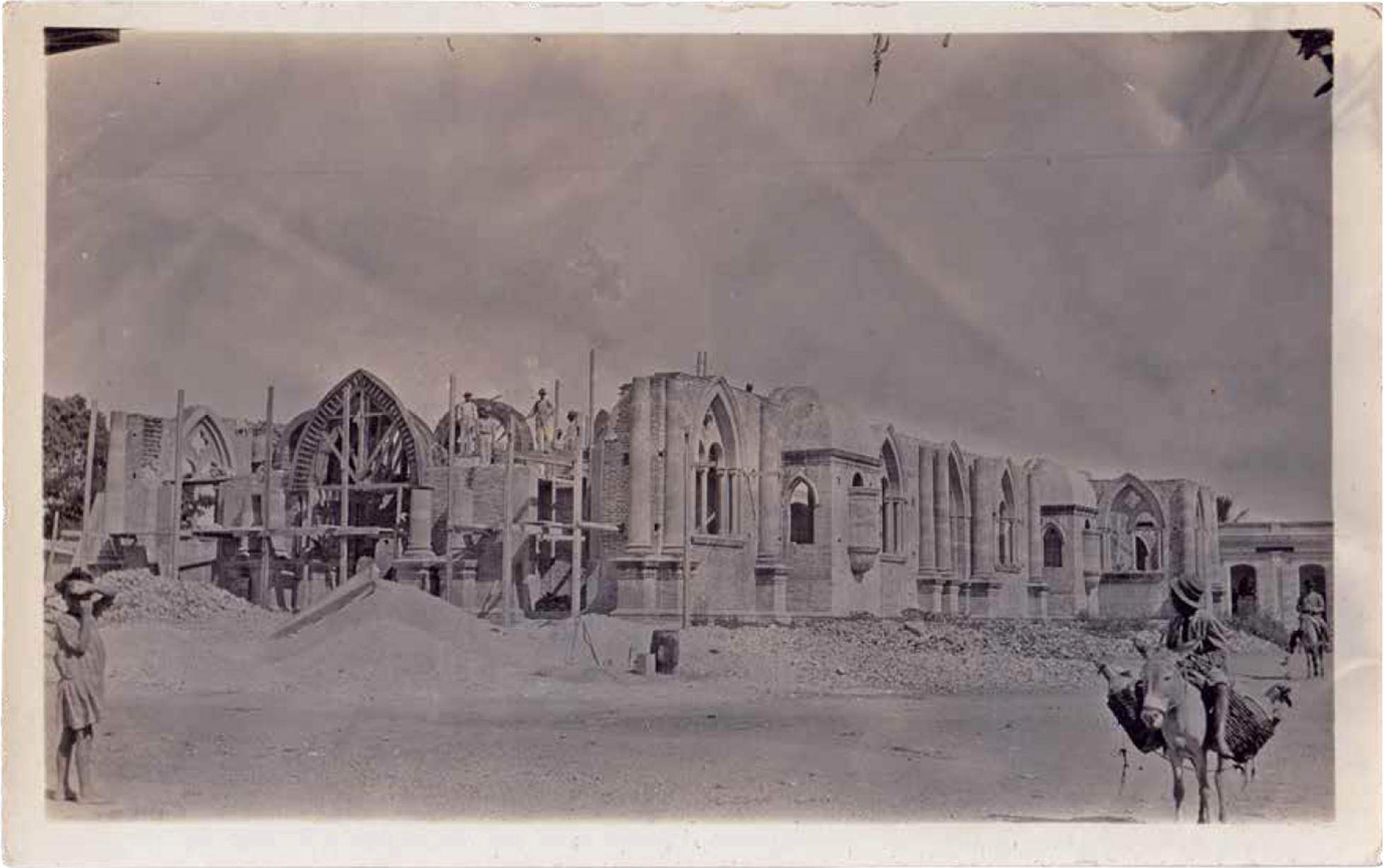
The Rise of a Modern Nation

The 1930 arrival of Rafael Leonidas Trujillo marked the start of three decades of a dictatorship that would completely change the built face of the country. The ruler charged civil engineers, architects and a diverse set of technicians with several urban renewal projects. Case in point: in 1935 our postage stamps celebrated the creation of seven bridges, while the ports of Santo Domingo, Puerto Plata and San Pedro de Macorís were the recipients of certainly generous investments. The country was being rebuilt eyeing a different set of standards. For example, that era saw the rise of the Catedral de Santa Ana in San Francisco de Macorís, a half-Gothic half-modern cathedral that fell in 1946 due to the country’s most intense earthquake to date.

Bring on the Tourists

This 1932 photo features a group of tourists at the site of the Jacagua ruins, the original birthplace of Santiago de los Caballeros. In a few years, the country would go from having small lodgings such as the Presidente Hotel —located on the corner of 30 de Marzo Avenue and Mercedes Street, across Santo Domingo’s Parque Independencia— to the modern colossus that was the Jaragua Hotel right across the Caribbean Sea in the capital city —yet another one of Trujillo’s urban development works. Those were the years when the seeds of the buoyant tourism industry we’re now reaping were initially planted.

Looking Back, Looking Forward

Here’s a spot that should be quite familiar for many of Santo Domingo’s locals: Parque Colón in 1940s Ciudad Trujillo —the (megalomaniac) official moniker of our capital city during Trujillo’s reign. How many of those elements are still standing? Which have certainly changed? In Postcard Memories, our book now available for download, we’ve included a closing chapter that aims to answer those questions: Before and After showcases a series of postcards placed next to their 2020 counterparts, captured by photographers Sahira & Géber.

Videos

The team

Miguel D. Mena

Textos y selección de imágenes

Sahira & Geber

Fotografías

Pardo

Dirección de Arte y Diseño

Peter Weidlich

Traducción

Gema Imbert

Corrección ortotipográfica